


District 3, Dundy County, Nebraska
About
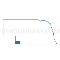
Outline

Summary
| Unique Area Identifier | 613119 |
| Name | District 3 |
| County | Dundy County |
| State | Nebraska |
| Area (square miles) | 482.66 |
| Land Area (square miles) | 482.28 |
| Water Area (square miles) | 0.38 |
| % of Land Area | 99.92 |
| % of Water Area | 0.08 |
| Latitude of the Internal Point | 40.16021640 |
| Longtitude of the Internal Point | -101.88307250 |
Maps


Graphs
Select a template below for downloading or customizing gragh for District 3, Dundy County, Nebraska


Neighbors
Neighoring Voting District (by Name) Neighboring Voting District on the Map
- Bird City Township Voting District, Cheyenne County, KS
- Calhoun Township Voting District, Cheyenne County, KS
- Champion/Lamar Precinct, Chase County, NE
- Cleveland Run Township Voting District, Cheyenne County, KS
- District 1, Dundy County, NE
- District 2, Dundy County, NE
- Wano 1 Township Voting District, Cheyenne County, KS
- Yuma 1, Yuma County, CO
- Yuma 7, Yuma County, CO
Top 10 Neighboring County Subdivision (by Population) Neighboring County Subdivision on the Map
- Wray CCD, Yuma County, CO (4,088)
- Wano township, Cheyenne County, KS (1,839)
- Benkelman No. 2 precinct, Dundy County, NE (701)
- Bird City township, Cheyenne County, KS (687)
- Benkelman No. 1 precinct, Dundy County, NE (553)
- Champion-Lamar precinct, Chase County, NE (521)
- Benkelman No. 3 precinct, Dundy County, NE (310)
- Haigler precinct, Dundy County, NE (292)
- Ough precinct, Dundy County, NE (152)
- Cleveland Run township, Cheyenne County, KS (54)
Top 10 Neighboring Place (by Population) Neighboring Place on the Map
Top 10 Neighboring Unified School District (by Population) Neighboring Unified School District on the Map
- Wray School District RD-2, CO (3,958)
- Chase County Schools, NE (3,225)
- Dundy County Public Schools, NE (2,501)
- St. Francis Community Schools Unified School District 297, KS (2,016)
- Cheylin Unified School District 103, KS (1,065)
Top 10 Neighboring State Legislative District Lower Chamber (by Population) Neighboring State Legislative District Lower Chamber on the Map
Top 10 Neighboring State Legislative District Upper Chamber (by Population) Neighboring State Legislative District Upper Chamber on the Map
- State Senate District 1, CO (125,154)
- State Senate District 40, KS (61,332)
- State Senate District 44, NE (33,011)
Top 10 Neighboring 111th Congressional District (by Population) Neighboring 111th Congressional District on the Map
- Congressional District 4, CO (725,041)
- Congressional District 1, KS (655,310)
- Congressional District 3, NE (561,378)
Top 10 Neighboring Census Tract (by Population) Neighboring Census Tract on the Map
- Census Tract 9631, Yuma County, CO (4,602)
- Census Tract 9619, Chase County, NE (3,966)
- Census Tract 9502, Cheyenne County, KS (2,726)
- Census Tract 9623, Dundy County, NE (2,008)
Top 10 Neighboring 5-Digit ZIP Code Tabulation Area (by Population) Neighboring 5-Digit ZIP Code Tabulation Area on the Map
- 80758, CO (3,795)
- 67756, KS (2,016)
- 69021, NE (1,348)
- 67731, KS (675)
- 69023, NE (440)
- 69030, NE (324)
- 69041, NE (161)